|   |
May 29-31, 2003
The Alliance’s 25th annual meeting, held May 28-31, 2003 at ThorpeWood, a remote retreat in the mountains near Frederick, Maryland was a resounding success. We all found ThorpeWood to be a wonderful modern adaptation of park rustic and sustainable “green” architecture and site design.The planning committee would like to express thanks to the many people–speakers, tour guides, resource people, moderators, planners, etc. for making this a memorable and fitting celebration of our 25th anniversary.

Sky Meadows State Park, May 2003
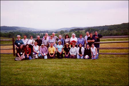
Approximately 30 old friends and new started off the annual meeting Wednesday evening with a buffet dinner followed by our traditional “roundtable” introductions. We all caught up with each other’s activities from cemetery preservation, to academic pursuits to the National Park Service’s recent commemoration of the Flight 93 National Monument in Pennsylvania.With the theme of Preservation on the Edge: Historic Landscape Challenges on the Exurban Fringe, the presentations and discussions revolved around international, statewide and county efforts using zoning, agricultural land preservation programs and smart growth initiatives as means to preserve open space and historic landscapes.
The meeting began with an international perspective on community-based resource values, followed by state and local case studies depicting how local values were incorporated into the land preservation process. Several of the initial presentations introduced the group to the highly effective statewide programs in Maryland such as the Rural Legacy Program, and the variably effective agricultural land preservation programs implemented by the counties, showcased through Frederick and Howard county case studies. Long an advocate for Smart Growth, former Maryland Governor Parris Glendening created a highly successful state program that has been nationally recognized. In essence the program offers various incentives to those communities that concentrate development such that open space and prime agricultural areas can remain undeveloped, in production and preserved. Maryland’s statewide program widely influenced other states to create similar initiatives throughout the country. With the strength of the state behind the Smart Growth and rural land preservation programs, Maryland’s counties have made major progress in creating pots of money and ultimately setting aside land into permanent protection.
Other interesting presentations included African-American Hillside landscapes, highway planning in rural Pennsylvania, battlefield preservation initiatives and a “lessons learned” case study about the Cooper River Historic District nomination process in South Carolina. In the final presentation of the day, the group was provided an introduction into how the state of Virginia has approached growth and land protection in a very different way from the state of Maryland. Because Virginia uses the Dillon Rule (unless the state legislates it, a municipality cannot do it), and there are few statewide programs for land protection, Virginia counties and municipalities have had to be creative in how to protect their open space and historic landscapes. Virginia counties/municipalities have been protecting land through their comprehensive planning process and tax incentives emphasizing continued agricultural use. Virginia leads all other states in the U.S. in the number of rural districts in the state as well as the overall amount of acreage protected through landmark and National Register designations. We learned that Loudoun County is currently implementing an innovative “green infrastructure” plan that defines conservation easements. As a wrap up, the group was introduced to the sights they would be seeing on the field trip into Virginia’s Loudoun, Clarke and Fauquier counties the next day. Because of their proximity to the Washington, D.C. metropolitan area, these counties are some of the most intensely developed and highly pressured areas to grow within the country. Yet, there are also an amazing amount of conservation easements within these counties as well.
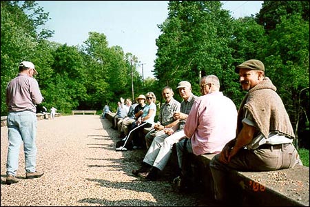
Friday’s field trip was a whirlwind tour of over 100 miles of Maryland and Virginia’s pastoral landscapes along rural roads, major highways and through historic town centers. Beginning in Maryland, the group stopped at Point of Rocks, MD to hear about the efforts underway by citizens and the Carrollton Manor Trust, a fairly new but highly successful land trust that has engaged local citizens to participate in the planning, development and land protection process for their communities.
Upon leaving the land trust group, our band of merry wanderers crossed the Potomac River led by David Edwards of Virginia’s Department of Historic Resources (SHPO office). Immediately after crossing the river we entered the first of five rural/agricultural districts in the Virginia countryside we were to visit that day, the 25,000-acre Catoctin Rural Historic District. Upon leaving the Catocin Rural Historic District we wandered on into Waterford, VA, a very intact colonial settlement, one of the first National Historic Landmark districts in the country. Although long protected, Waterford is heavily pressured by a fringe development of McMansions, and is currently threatened by a land developer that has bought fragile land inside the town perimeter – what was at one time considered “protected in perpetuity.” After talking with a Waterford Foundation advocate about the issues and touring through the small hamlet briefly, we continued on into the 10,000 acre Goose Creek Historic District, one of the few working agricultural landscape districts in Virginia. We traveled along the old Snickersville Turnpike with its dry laid stonewalls and rural character to the town of Bluemont at the foot of the Blue Ridge Mountains. As we climbed and crossed the Blue Ridge, Appalachian Trail, and the Shenandoah River the views were incredible as they contained scenic diversions as well as views of encroaching sprawl development. We continued on our journey through and adjacent to the 10,290 acre Long Marsh Historic District in the town of Berryville, VA.
Sky Meadows State Park, May 2003
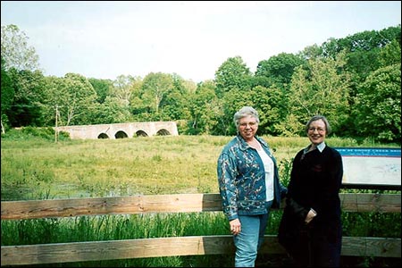
Berryville has historically been the seat of Clarke County, VA as well as a regional center for marketing and shipping agricultural products. We passed many interesting railroad buildings, granaries and storehouses dotted along either side of the railroad tracks. Leaving Berryville we crossed into the Greenway Rural Historic District, location of 17th century Lord Fairfax’s colonial holdings. Located in the center of the Greenway RHD, is the 712-acre Virginia State Arboretum, also known as the Blandy Experimental Farm Historic District. The Blandy Experimental Farm Historic District was fascinating for although as the state arboretum it has one of the largest collections of trees and shrubs in the eastern United States, it resides on a 19th century former estate known as the Tuleyries.Provided a nice lunch in a lovely setting, we were offered a great introduction to the arboretum and further insight into Clarke County planning, zoning and development issues. We left the 19,000 acre Greenway Historic District crossed back over the winding Shenandoah River up over the Blue Ridge and back into the Piedmont on our way through Paris and up into Sky Meadows State Park, a Virginia State Park. Sky Meadow was a unique case study in protection that provided amazing views down a long valley that hasn’t been impacted too much by development yet. That valley is part of a proposed Crooked Run Valley Historic District still being defined. We continued on our way along the very scenic Zulla Road, where we saw a combination of 20th century gentleman farms near Middleburg along with stables, imposing Colonial Revival mansions, and rolling countryside of pasture and woods.
Sky Picnic supper, Goose Creek Bridge
Jerry Barkdoll and Susan Buggey, Goose Creek Bridge
The evening was beautiful as we enjoyed a lovely picnic supper on the historic stone-arched Goose Creek Bridge which was built ca. 1805 and was the site of a clash between Union and Confederate troops. Now acting as a trail, the abandoned bridge is located on a former alignment of Route 50, a road that is now a heavily traveled major commuter route into western Virginia out of Washington, D.C. Located in the midst of the Mosby Heritage Area, we learned about the adventures of John Mosby, a local Civil War patriot of the Blue Ridge. The unique aspect of the Mosby Heritage Area is that it is literally a grassroots effort that has not relied on federal or state funding to define it or provide continued support. After a long day, the bus headed back to ThorpeWood via the Catoctin Rural Historic District crossing through the Leesburg Historic district, one of Virginia’s earliest county seats, passing Oatlands, a National Trust for Historic Preservation property and on in to Frederick.Saturday morning we wrapped up the presentations discussing landscape preservation initiatives in Massachusetts, a Midwest land trust known as the Prairie Land Trust and the Historic American Landscapes Survey (HALS). For the final session, the group gathered around ThorpeWood’s massive native stone hearth seated in rustic-style log furniture to chat with Robert Melnick and Arnold Alanen. The two led a conversation of lessons learned in the essays they edited for their prize-winning book, Preserving Cultural Landscapes in America. The discussion was thoughtful as we all commented on how far both the Alliance and the field of landscape preservation has come and what lies ahead.
With an afternoon field trip to Monacacy Battlefield, a National Park Service site, people were introduced to a small but wonderful battlefield resource on the edge of Frederick. The site provides insight into a cross section of continued land use from the early 1800s, to the Civil War battle it has been preserved on behalf of, to the mid 1900s. With a few spare hours to wander around Frederick after the battlefield tour, we all rendezvoused at Isabella’s in downtown Frederick to celebrate 25 years of advocating for historic landscape preservation at our annual banquet.
Kudos to Camille Fife who did an excellent job coordinating a rotating slide show of past annual meeting sites, members and activities. Tina Bishop created a wonderful timeline of Alliance history and activities. Robert Melnick, Shary Berg, Barbara Wyatt, Susan Buggey and Camille Fife all gave overviews of the various eras of the Alliance, from its initial “we’re not an organization” stage to its education and advocacy publications, to its recent strategic planning efforts to determine the direction and continued effectiveness of the organization into the 21st century. Many shared their thoughts and reflections on the various meetings, events, and members who have inspired them over the years, while also providing enthusiastic outlook for the future of the Alliance and the field of landscape preservation.
All had a grand time and look forward to next year’s annual meeting in the wine country of San Francisco, California!
Arnold Alanen and Robert Melnick, The Making of Preserving Landscapes in America
Shary Berg, Landscape Preservation Initiatives in Massachusetts
Susan Buggey and Nora Mitchell, Cultural Landscapes: Venues for Community-Based Conservation
Pamela Bush, Rural Land Preservation in Maryland
Janet Davis, Introduction to Frederick County’s History
Jeffrey C. Everett, Rural Landscape Preservation in Maryland’s Piedmont Region: Lessons Learned From Howard County, Maryland
Cari Goetcheus, The Historic American Landscapes Survey
Carol Grove, The Prairie Garden Trust
Linda McClelland, Historic Preservation Legislation in the United States: A Timeline
Kate Miller, Loudoun County’s Measured Response to Unprecedented Growth
Cindy Ptak, The National Road in Maryland
Paula Reed, Initiatives for Battlefield Preservation in Central Maryland
Cecelia Rusnak and Thomas Yahner, The Jury’s Still Out: Community Reaction to Highway Planning in a Rural Landscape
Daniel Vivian, Landscape Preservation and Public Controversy in Coastal South Carolina: The Cooper River Historic District
Edie Wallace, Preservation of Western Maryland Hillside Landscapes: Historic African American Rural Communities
Umit Yilmaz and Dan Nadenicek, A Tale of Two Cemeteries: Public Participation and History in Greenville, South Carolina
Planning and Rural Preservation in Frederick County
Ed Gorski, An Overview of Frederick County Initiatives
John Fieseler, Frederick County Tourism Initiatives
Stephen O’Philips, Forest Conservation in Frederick County
Tim Blaser, Farmland Preservation Programs in Frederick County
On Site Panel: Grass Roots Initiatives in Southern Frederick County
Nancy Bodmer, Joy Clem, and Marcel Aillery
On Site Panel: Historic Preservation in Clarke County
David Edwards, Maral Kalbian, and Chuck Johnston
Closing Panel: Preservation on the Edge: What works? Who are the stakeholders? What are the lessons of the ThorpeWood meeting? How do they apply elsewhere? What challenges lie ahead? Where do we go from here?
Arnold Alanen, Camille Fife, Robert Melnick, HIgh Miller, Susan Buggey, Dan Nadenicek, Linda McClelland (moderator)
On Site Presentation
Susan Trail, Battlefield Preservation at Monocacy